


STOKES Voting District, Union County, Illinois
About
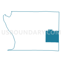
Outline

Summary
| Unique Area Identifier | 574968 |
| Name | STOKES Voting District |
| County | Union County |
| State | Illinois |
| Area (square miles) | 33.53 |
| Land Area (square miles) | 33.38 |
| Water Area (square miles) | 0.15 |
| % of Land Area | 99.57 |
| % of Water Area | 0.43 |
| Latitude of the Internal Point | 37.42687350 |
| Longtitude of the Internal Point | -89.10885750 |
Maps


Graphs
Select a template below for downloading or customizing gragh for STOKES Voting District, Union County, Illinois


Neighbors
Neighoring Voting District (by Name) Neighboring Voting District on the Map
- ANNA 7 Voting District, Union County, IL
- BALCOM Voting District, Union County, IL
- CACHE Voting District, Johnson County, IL
- DONGOLA 1 Voting District, Union County, IL
- DONGOLA 2 Voting District, Union County, IL
- ELVIRA Voting District, Johnson County, IL
- LICK CREEK Voting District, Union County, IL
Top 10 Neighboring County Subdivision (by Population) Neighboring County Subdivision on the Map
- Lick Creek precinct, Union County, IL (1,094)
- Dongola District 1 precinct, Union County, IL (872)
- Elvira precinct, Johnson County, IL (820)
- Stokes precinct, Union County, IL (800)
- Anna District 7 precinct, Union County, IL (774)
- Cache precinct, Johnson County, IL (593)
- Dongola District 2 precinct, Union County, IL (584)
- Balcom precinct, Union County, IL (418)
Top 10 Neighboring Elementary School District (by Population) Neighboring Elementary School District on the Map
- Anna Community Consolidated School District 37, IL (7,074)
- Lick Creek Community Consolidated School District 16, IL (1,232)
- Cypress School District 64, IL (977)
- Buncombe Consolidated School District 43, IL (693)
Top 10 Neighboring Secondary School District (by Population) Neighboring Secondary School District on the Map
- Anna Jonesboro Community High School District 81, IL (11,297)
- Vienna High School District 133, IL (8,892)
Top 10 Neighboring Unified School District (by Population) Neighboring Unified School District on the Map
Top 10 Neighboring State Legislative District Lower Chamber (by Population) Neighboring State Legislative District Lower Chamber on the Map
Top 10 Neighboring State Legislative District Upper Chamber (by Population) Neighboring State Legislative District Upper Chamber on the Map
Top 10 Neighboring 111th Congressional District (by Population) Neighboring 111th Congressional District on the Map
Top 10 Neighboring Census Tract (by Population) Neighboring Census Tract on the Map
- Census Tract 9501, Union County, IL (4,259)
- Census Tract 9505, Union County, IL (3,770)
- Census Tract 9778, Johnson County, IL (3,618)
- Census Tract 9777, Johnson County, IL (2,979)